

There Are five 'known" Kailashs in This World. Most People Only Know One.
Everyone knows about Mount Kailash in Tibet.
The sacred peak of Lord Shiva. The center of the universe in Hindu, Buddhist, Jain, and Bon cosmology. The destination that requires a Chinese permit, months of planning, and a journey across international borders that gets more complicated every passing year.
What most people don't know — including many devout pilgrims who have spent years dreaming of Mount Kailash — is that there's another one. Right here in India. In Uttarakhand. Accessible without a Chinese permit. Without crossing into Tibet. Without the bureaucratic complexity that makes the original increasingly difficult to visit.
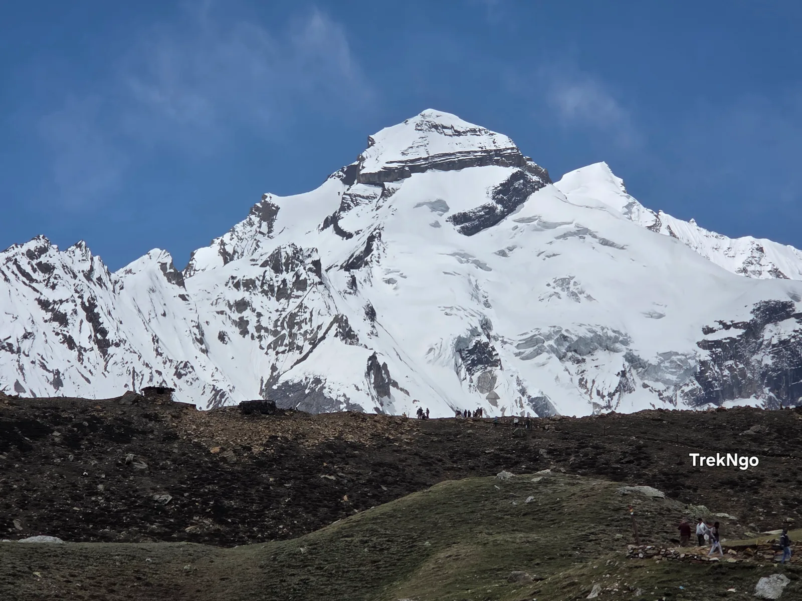
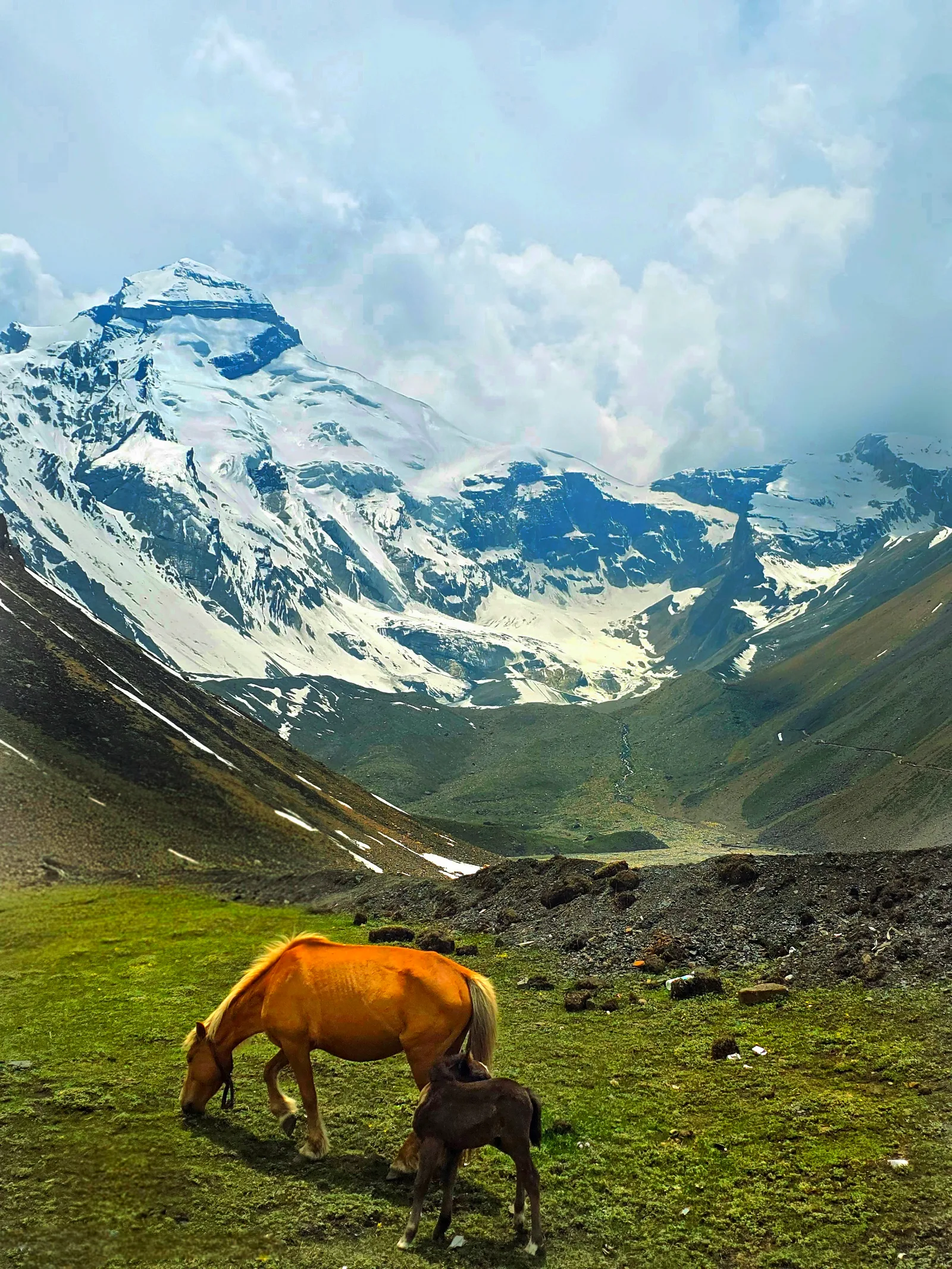
The Adi means original, ancient, primeval. And that's precisely what this mountain is — a sacred peak in the Pithoragarh district of Uttarakhand that mirrors the form of Mount Kailash so precisely that it has been venerated as Shiva's original abode since before recorded Hindu history. Sitting at an altitude of 6,191 meters, flanked by the Parvati Sarovar lake at its base and the extraordinary Kuti valley below it, Adi Kailash doesn't imitate the Tibetan Kailash — it predates it in spiritual significance for the communities who have lived in its shadow for generations.
A peak nearby that carries a naturally formed Om symbol — the sacred syllable of Hinduism — etched in snow across its face. Not painted. Not carved. Naturally occurring. In the right season and the right light, it is one of those things that stops rational thought completely.
In 2026, with the Char Dham circuit increasingly crowded and international yatra options complicated by geopolitics, Adi Kailash has emerged as arguably the most spiritually profound and visually extraordinary journey available entirely within Indian borders.
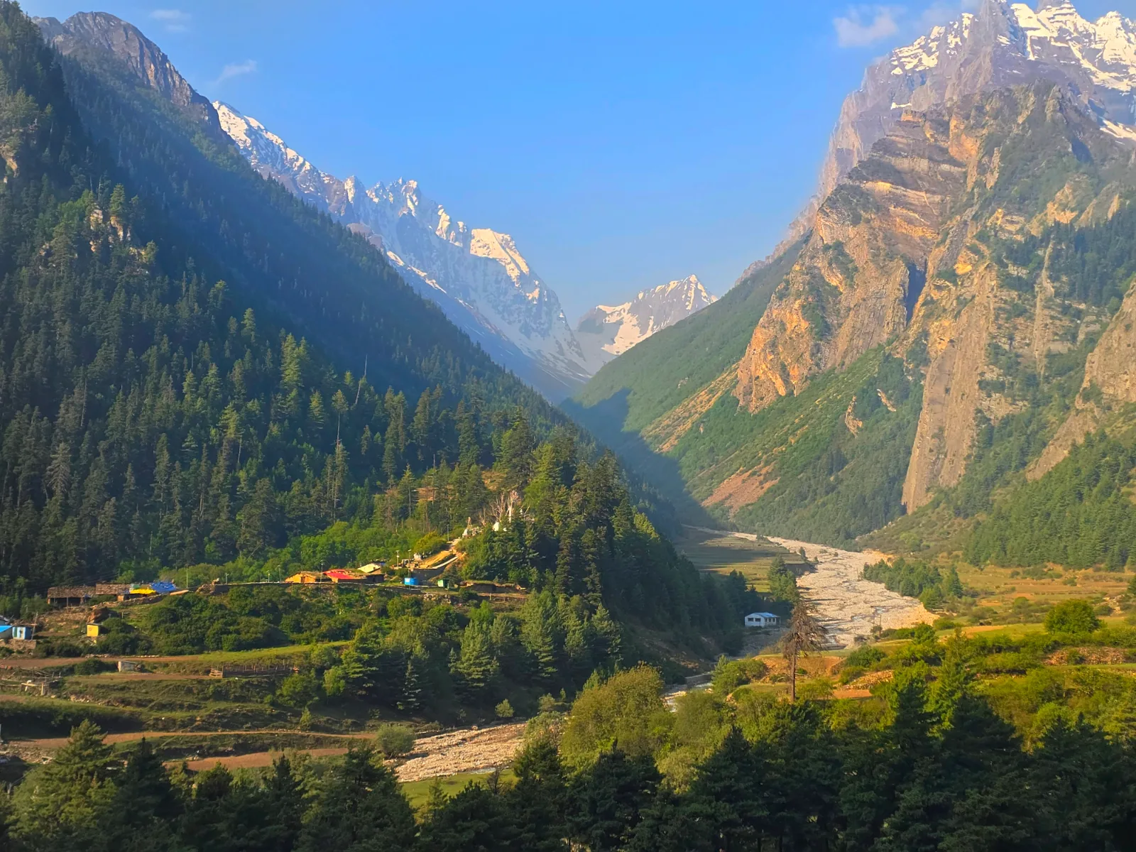
Adi Kailash — also known as Chhota Kailash (Little Kailash) — is a sacred Himalayan peak rising to 6,191 meters in the Pithoragarh district of the Kumaon Himalaya, Uttarakhand. It sits in the upper Kali River valley near the India-Nepal border, within the high-altitude landscape of the Vyas Valley — one of the most remote, culturally rich, and visually spectacular corridors in the entire Indian Himalaya.
The mountain's religious significance in Hindu tradition is immense. It is one of the Panch Kailash — the five sacred peaks associated with Lord Shiva — and is considered by many scriptures to be the original abode of Shiva and Parvati, predating even the Tibetan Mount Kailash in devotional importance. The Parvati Sarovar lake at its base mirrors the Mansarovar Lake of the Tibetan Kailash in spiritual symbolism — a sacred water body believed to possess extraordinary purifying powers.
The journey to Adi Kailash is simultaneously a pilgrimage, a high-altitude road and trek journey, and one of the most culturally immersive experiences available in the Indian Himalaya. The route passes through ancient border trade villages, along the India-Nepal boundary marked by the Kali River, through landscapes that shift from subtropical river valleys to high-altitude meadows to glaciated mountain terrain — all within a single journey.
Om Parvat — formally known as Om Parvati Peak — is a separate mountain visible from Nabi village and on the approach drive. Its snow face bears a naturally formed Om (ॐ) symbol that appears in the right conditions between approximately July and October. The Om is formed by the differential deposition and melting of snow across the peak's south-facing rock structure. Witnessing it is considered among the most auspicious experiences available in the Indian Himalaya.
Location: Pithoragarh District, Uttarakhand
Sacred Peak Altitude: 6,191m (Adi Kailash)
Base Point for Darshan: Kuti Village (~3,700m)
Journey Starting Point: Tanakpur or Pithoragarh
Route Distance (One Way): ~330 km (Tanakpur to Kuti)
Total Trip Duration: 10–14 Days (recommended)
Best Season: June to October
Difficulty: Moderate (road journey) + Easy Hikes at destination
Inner Line Permit: Mandatory for Indian and Foreign Nationals
Nearest Airport: Pantnagar Airport (295 km from Pithoragarh)
Nearest Railway: Tanakpur Railway Station
Tanakpur → Champawat → Pithoragarh → Dharchula → Pangla → Budhi → Garbhyang → Gunji → Nabi → Kuti → Adi Kailash
Before diving into the day-by-day itinerary, understand this: the road to Adi Kailash is not a means to an end. It is the experience. Every kilometer from Dharchula onward delivers a landscape, a cultural encounter, or a geographical revelation that would justify the journey even if the destination didn't exist.
The route follows the ancient Kailash Mansarovar Yatra path — the same corridor that pilgrims have walked for centuries on their way to Tibet — through a landscape that carries the accumulated weight of that devotion in every village, every temple, every mountain view.
Drive Distance: ~150 km | Duration: 5–6 hours | End Altitude: 1,814m
Tanakpur doesn't look like the beginning of something sacred. A modest plains town at the edge of the Kumaoni hills, it functions as the primary rail and road gateway into the deeper Kumaon — and for the Adi Kailash journey, it's where everything starts.
Most travelers arrive in Tanakpur by overnight train from Delhi or by road from Haldwani and Bareilly. If you're arriving by train, the Tanakpur Express connects well with Delhi and the broader northern rail network. Get here, eat breakfast, and get moving — the drive to Pithoragarh deserves daylight.
The Drive:
The road from Tanakpur climbs steadily through Champawat district, gaining altitude through dense sal and mixed hill forest before the terrain opens into proper Kumaoni hill country. The transition happens gradually — which is exactly right, both for acclimatization and for the mental unwinding that this kind of journey requires.
Champawat is worth a brief stop if timing allows. The town served as the ancient capital of the Chand dynasty rulers of Kumaon, and the Baleshwar Temple complex here is one of the finest examples of medieval Kumaoni stone temple architecture still standing. It takes twenty minutes to walk through and it sets the cultural tone for everything ahead.
From Champawat, the road continues northeast toward Pithoragarh through increasingly dramatic hill terrain. The views approaching Pithoragarh from the south — the town sitting in its valley bowl with ridgelines rising on all sides — are the first genuine Himalayan visual reward of the journey.
Arriving in Pithoragarh:
Pithoragarh at 1,814 meters is the last proper town before the route enters genuinely remote territory. It has banks, ATMs, pharmacies, medical facilities, restaurants, and all the practical infrastructure that disappears progressively over the next four days. Use the afternoon well.
Two things to handle before tomorrow:
First, if you haven't already arranged your Inner Line Permit through TreknGo, the District Magistrate's office in Pithoragarh is where Indian nationals can obtain one in person. Foreign nationals need a Protected Area Permit arranged well in advance — TreknGo handles this completely for international clients at www.trekngo.com.
Second, withdraw cash. Enough for the entire journey beyond here. The ATM situation deteriorates significantly after Pithoragarh and is effectively absent beyond Dharchula.
Evening in Pithoragarh is straightforward — a good meal, early sleep. Tomorrow's drive is the one that changes the journey's character completely.
Overnight: Pithoragarh
Drive Distance: ~96 km | Duration: 4–5 hours | End Altitude: 915m
The drive from Pithoragarh to Dharchula is where this journey stops being an ordinary hill trip and becomes something else entirely.
The road descends from Pithoragarh into the Kali River valley and then follows the river northward — and within the first few kilometers of reaching the Kali, you encounter a geographical reality that takes a moment to fully process: the river running beside you is an international border. India is on your left. Nepal is on your right. The same water, the same current, separating two countries that you could shout across on a quiet morning.
This isn't a metaphor. The Kali River — known in its upper reaches as the Mahakali — forms the actual, legal, political boundary between India and Nepal through this entire corridor. The villages on the opposite bank are Nepali. The faces looking across the water are Nepali. The prayer flags on the hillside across the gorge are in Nepal.
The communities on both banks — the Rang people who have inhabited this valley for centuries — treat that border with the practical pragmatism of people whose families, trade routes, and cultural practices predate it by generations. But for a traveler seeing it for the first time, the Kali River as international boundary is one of those facts that lands differently in reality than on a map.
A Note on Nepal:
Depending on current border arrangements and your documentation, the Dharchula-Darchula crossing point offers the possibility of briefly entering Nepal — the town of Darchula sits directly across the river from the Indian Dharchula, separated by a bridge and a customs post. This makes the Adi Kailash journey, almost incidentally, a dual-country experience. Confirm current crossing arrangements with TreknGo before departure.
Arriving in Dharchula:
Dharchula sits at the confluence of the Dhauliganga and Kali rivers at 915 meters — lower than Pithoragarh, warmer, busier, and carrying the particular energy of a genuine border town. It's the last place on this route with reliable mobile connectivity, multiple accommodation options, and easy access to supplies.
Today is a rest day at Dharchula — and that rest is deliberate. Tomorrow's drive to Gunji is the most demanding road section of the entire journey. Arriving at Dharchula with a full day of rest ahead of it means you approach tomorrow's road well-fed, rested, and mentally prepared for what it actually involves.
Spend the afternoon walking Dharchula's main market, watching the Kali River from the ghats, and eating well. The food options here are simple but good — dal, rice, fresh rotis, local vegetables. Eat more than you think you need.
Sleep early.
Overnight: Dharchula (915m)
Drive Distance: ~100 km | Duration: 6–8 hours | End Altitude: 3,106m
This is the day people remember.
Not because it's comfortable — it isn't. Not because it's fast — it isn't that either. But because the road from Dharchula to Gunji delivers a sequence of landscapes, geographical revelations, and driving experiences that compress more of the Indian Himalaya into a single day than most travelers encounter in weeks.
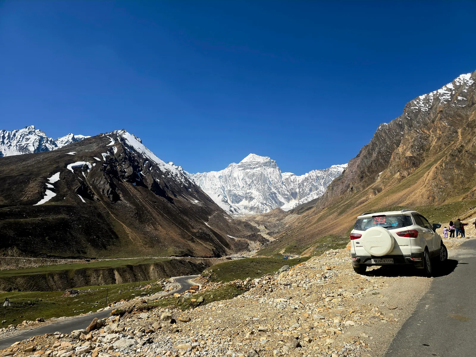
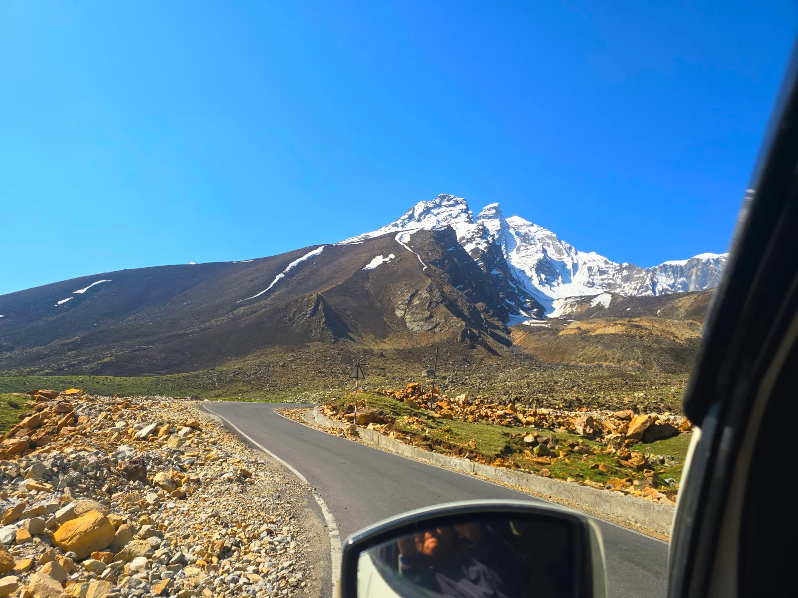
Your vehicle from this point is a 4×4 or capable SUV. This isn't optional. Beyond Dharchula, the road requires it — not as a preference but as a physical reality of what the terrain demands.
Dharchula to Pangla — and the S-Bend:
The road beyond Dharchula begins climbing immediately along the Kali River gorge. Within the first few kilometers, the landscape shifts completely — the river is now far below, Nepal's hills are visible across the gorge, and the road narrows to the width that defines this entire corridor.
The views through this section are extraordinary. The Kali carves a serious gorge between the two countries and the road follows its contours with the river as a constant companion — roaring and cold and marking the boundary between India and Nepal with the indifference of water that has been here far longer than either country.
Then comes the S-bend at Pangla.
The S-bend is exactly what it sounds like — a road section that curves in a tight double-bend along a steep mountainside, with a significant drop on one side and solid rock face on the other. It is navigable. Local vehicles, goods trucks, and pilgrim convoys cross it regularly. But it requires a competent driver in an appropriate vehicle and, critically, dry conditions.
In rain, the S-bend becomes a different calculation entirely. The road surface when wet demands everything your driver has — slow speed, precise line, no unnecessary inputs. TreknGo's drivers know this section across multiple seasons and multiple weather conditions. This is one of the concrete reasons an experienced local operator matters on this route.
Past the S-bend, the terrain continues climbing through progressively wilder landscape as Nepal's peaks begin appearing on the eastern horizon.
Budhi Village:
Budhi sits at roughly 2,150 meters and offers the first genuinely panoramic views of the journey. Standing in Budhi and looking north and east, the peaks of the Nepal Himalaya — Api (7,132m) and Nampa (6,755m) from the Api Himal group — appear above the ridgelines with a clarity that surprises most first-time visitors. Seven-thousand-meter peaks in a neighboring country, visible from a roadside village in Uttarakhand. The geography of this border zone operates at a scale that consistently reframes what travelers think they know about the Himalaya.
The 36 Hairpin Bends After Budhi:
Beyond Budhi, the road climbs through 36 hairpin bends — a section with its own reputation among Adi Kailash veterans. Unlike the S-bend, these hairpins are more consistently engineered and better maintained. The road surface is generally good and the bends, while tight, are predictable. What they deliver — beyond the mild entertainment of counting them (most people lose count by bend fifteen) — is a sustained elevation gain with expanding views at every turn.
By the final hairpin, you're at a meaningfully higher altitude with a view that makes the counting worthwhile.
Garbhyang:
Between the hairpin section and Gunji lies Garbhyang — a traditional Rang community village that offers a window into the indigenous cultural life of the Byans Valley. The stone architecture, the relationship between the settlement and the surrounding landscape, the pace of life at this elevation — it's worth slowing down through here rather than treating it as a transit point.
Arriving at Gunji (3,106m):
Gunji is the operational hub of the upper Byans Valley and the base from which both the Om Parvat and Adi Kailash excursions depart. The ITBP checkpoint here verifies Inner Line Permits for all travelers — have your documentation accessible and in order.
At 3,106 meters, the altitude announces itself. The sky is deeper blue. The air is thinner. The surrounding peaks are visible in a way they weren't from the valley below. Rest, eat, hydrate aggressively, and let the altitude do its gradual work on your body.
The effort of today's drive is the price of entry to what the next two days deliver.
Overnight: Gunji (3,106m)
Drive Distance: ~36 km round trip | Duration: Half day | Max Altitude: ~3,600m at viewpoint
The alarm goes off before the valley is fully light, and the cold that greets you outside your door at Gunji is the specific cold of high altitude — dry and immediate and clarifying in a way that lower-altitude cold never quite is.
Leave by 6:30 AM. The morning light window matters here.
The Drive to Om Parvat:
The road from Gunji toward Nabi village and then to the Om Parvat viewpoint — approximately 18 kilometers — passes through the high-altitude Byans Valley in its most open and dramatic form. The morning light across the surrounding peaks in this first hour of the day is the finest light the valley offers. Go at this hour for this reason.
The drive itself is the experience, not merely the means to one. High-altitude birch forest, the Kali River narrowing as it approaches its source, peaks rising on both sides of the valley, and the particular silence of a Himalayan morning before the day fully begins.
Om Parvat:
And then the peak comes into view.
On the south face of Om Parvati Peak, snow has accumulated — and continues to accumulate year after year — in a formation that produces the Sanskrit symbol ॐ in white against the dark rock. The Om is formed by the differential retention of snow across the peak's rock geometry: where the structure retains snow, white. Where it doesn't, the contrasting rock face below.
The rational explanation is meteorological and geological. It doesn't help.
Standing in front of Om Parvat and seeing the most sacred syllable in the Hindu tradition written across a Himalayan peak in snow — naturally, without human intervention, in the same location across generations of witness — is one of those experiences that operates below the level where explanation is useful.
Bring binoculars. The Om is clearly visible to the naked eye but the binoculars bring a resolution that changes the experience.
The best visibility window is July through early October, when the surrounding snow has receded enough to provide contrast while the Om formation itself remains intact. The morning light of this specific hour is when the definition is sharpest.
Spend as long as the morning allows here. Return to Gunji by midday.
Afternoon at Gunji:
Rest. This is not wasted time — it is deliberate acclimatization ahead of tomorrow's Adi Kailash approach. The altitude gain of the past two days is significant and the body needs unhurried time to adjust. Eat well, drink water continuously, and sleep early.
Your TrekNgo trek leader will brief the group on tomorrow's route, health checks, and the specific logistics of the Kuti approach in the evening.
Overnight: Gunji (3,106m)
Drive Distance: ~36 km to Kuti (one way) | End Altitude: 3,600m at Kuti | Hiking: 1–4 km at destination
Every day of this journey has been pointing here.
Departure: 6:00 AM. Not 6:30. Not "around six." The morning light on Adi Kailash — and the quality of the approach drive at dawn — justifies the early alarm without argument.
Gunji to Nabi:
The drive from Gunji northward through Nabi continues deeper into the upper Byans Valley. Nabi is the last significant settlement before Kuti and the Om Parvat viewpoint is accessible from here as well — on a clear morning the peak is visible above the valley without even stopping the vehicle.
Beyond Nabi, the landscape enters its final high-altitude form. The valley narrows and then opens into broad alpine terrain. Birch and juniper forest flanks the lower sections of the road before the vegetation thins completely and the open glacial landscape above takes over. The Kali River, which has been a companion since Dharchula, narrows here toward its source in the glaciers above.
Arriving at Kuti Village (~3,600m):
Kuti is the last village before Adi Kailash. And it is cold — genuinely, uncompromisingly cold in a way that the word doesn't fully prepare you for. Even in July, when the plains three hundred kilometers south are at 40°C, Kuti operates in a different thermal reality. Morning temperatures drop well below zero. The wind off the glacier above the village removes any remaining warmth the sun provides.
The village sits in a broad alpine meadow at 3,600 meters — traditional stone houses, yaks on the meadow edges, prayer flags in the wind, the sky at this altitude a shade of blue that has no equivalent at lower elevations. The Rang community that has maintained this settlement through centuries of extreme high-altitude life receives pilgrims and travelers with a warmth that makes the cold feel incidental.
From Kuti, looking northward, Brahma Parvat rises above the valley. And beyond it, above the ridge, comes the first glimpse of Adi Kailash.
The first view is not dramatic. It arrives quietly — a peak above a ridgeline, snow and rock in the morning light. But something about it stops people. There is a quality of presence to this mountain that operates independently of its altitude or its visual scale. People who have stood below both the Tibetan Kailash and Adi Kailash describe something similar in the experience of each — a mountain that feels inhabited in a way that purely geological formations don't.
The Two Hikes from Kuti:
Parvati Sarovar — Approximately 1 km One Way
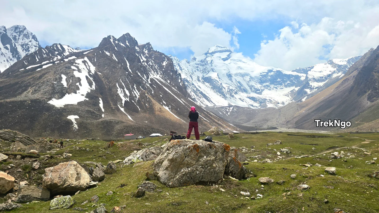
The Parvati Sarovar is the sacred glacial lake sitting immediately below the face of Adi Kailash. The walk from Kuti to the lake is gentle — a short trail through the upper meadow terrain above the village that reaches the lake's edge in thirty to forty-five minutes.
The approach reveals the lake and the peak simultaneously. Adi Kailash rising directly above the water, the peak reflected in the lake's surface on calm mornings, the silence of a high-altitude sacred site at 3,700 meters — this is what the journey was for.
Pilgrims perform puja at the lake's edge. Many touch or enter the near-freezing water in a gesture of devotion that makes the temperature beside the point. Whether you participate in the ritual dimension or stand quietly at the water's edge, the Parvati Sarovar delivers something that genuinely resists description — which is perhaps the most honest thing that can be said about it.
Parvati Kund — Approximately 2 km One Way
The Parvati Kund hike takes you to the direct base of Adi Kailash — beyond the Sarovar, up through rocky alpine terrain and glacial moraine, closer to the mountain than any other accessible point on this route.
The trail beyond the Sarovar becomes more demanding — loose rock, glacial moraine, steeper gradients. Trekking poles are not optional here. Your TreknGo trek leader navigates the upper section where the path becomes less defined.
At Parvati Kund, at approximately 4,000 meters, Adi Kailash fills your entire upper field of vision. This proximity to a 6,191-meter sacred peak — standing at its base on glacial moraine with the mountain directly above — is the kind of physical and atmospheric experience that explains why people have been making this journey for longer than recorded history.
The silence here is thesilence of a place that has been here far longer than people have been coming to see it.
Both hikes can be done in the same morning — Parvati Sarovar first, then Parvati Kund, returning to Kuti by early afternoon. Combined distance is approximately 6 km round trip. Allow 4–5 hours total including time at each site.
Return Drive:
After the Kuti darshan and hikes, the drive back toward Gunji or Nabi for overnight stay follows the same road in reverse. The return carries everything the morning has added to it — the mountain, the lake, the cold, the silence — and the landscape through the Byans Valley looks different when you're carrying that weight.
Overnight: Gunji or Nabi Village
Drive Distance: ~100 km | Duration: 6–7 hours | End Altitude: 915m
The return from Gunji to Dharchula covers the same road as Day 3 — the 36 hairpin bends, Garbhyang, Budhi, the Pangla S-bend, the Kali River gorge — but the experience of driving it is genuinely different in the other direction.
Going in, the road was unfamiliar and the destination was anticipation. Coming back, the road carries the weight of what you've seen above it. The S-bend at Pangla, negotiated once successfully, has the familiarity of something already navigated. The hairpin bends descend rather than climb. The Nepal peaks visible from Budhi are now part of a landscape you've spent five days inside rather than approaching.
The S-Bend on Return:
The descent through Pangla requires the same respect as the ascent — more so in some ways, because downhill momentum on a wet mountain road adds a different dimension to the calculation. TreknGo drivers approach the return crossing with the same care as the initial one. Remain seated, stay calm, trust the driver.
The Kali River on Return:
Driving back through the gorge section with Nepal across the river, the boundary feels more familiar now — the same water, the same opposite bank, but seen through the accumulated experience of the days above it. Some things look different when you've been to their source.
Arriving back in Dharchula:
Dharchula at 915 meters, after five days above 3,000 meters, feels warmer and denser and more alive than it did when you left it. The relative abundance of the town — the market, the restaurants, the mobile connectivity returning to your phone — has a disproportionate appeal after the upper valley's austerity.
Eat well tonight. Sleep without the altitude's influence for the first time in days. Notice the difference.
Overnight: Dharchula (915m)
Drive Distance: ~246 km | Duration: 8–10 hours
The final day is a long drive and an honest one.
From Dharchula, the route retraces the journey's opening — south through the Kali River valley, back through Pithoragarh, down through the Champawat hills, and finally out of the mountains entirely and onto the plains at Tanakpur.
The drive covers the full altitudinal range of the journey in a single day — from the border town at 915 meters down to the Terai plains at 305 meters — and with it comes the complete reversal of the landscape sequence that began seven days ago. The hills that were rising on the outward journey are descending now. The plains that felt like a starting point are arriving as an ending.
Pithoragarh Stop:
A midday stop in Pithoragarh — for lunch, for a final ATM visit if needed, for the view of the hills you're leaving — is worth building into the day's timing. The town that felt like a gateway on Day 1 feels like a farewell now.
The Last Hours to Tanakpur:
The descent from the hills to Tanakpur through Champawat carries the final Kumaoni hill views of the journey. The forest, the small towns, the switchback road giving way to flatter terrain as the altitude drops — it's a gradual return to ordinary life that mirrors the gradual departure from it seven days ago.
Tanakpur arrival in the evening. The plains. The heat. The noise and movement of a town connected to everywhere.
The TrekNgo debrief — brief, practical, genuine — happens at the journey's end point. Trek certificates are distributed. Feedback is collected. And then the group disperses back into the logistics of return travel — trains, buses, cars — each person carrying something from the upper Byans Valley that wasn't there before.
All stay in guest houses on triple or double sharing basis depending on the group size
Dinner and Breakfast in all the stay
Taxi for entire tour as per the itinerary from Tanakpur to Tanakpur, if want to hire a taxi from different location - contact us.
All the inner line permit is included
Any extra meal
any extra sightseeing
pickup and drop from any another location (additional charges)
any porter service
Clothing: Thermal base layers × 3 (Kuti is genuinely cold; you will wear all of them) Heavy insulated down jacket (not a light packable; a real winter jacket) Waterproof hardshell outer layer
Warm fleece mid-layer, Trekking trousers × 2
Waterproof trekking boots, Wool trekking socks × 5–6 pairs
Heavy warm gloves (not thin gloves; proper winter gloves)
Balaclava or warm hat that covers ears
Light layers for lower altitude sections (Dharchula is warm)
Gear and Essentials: 40–50L trekking backpack Trekking poles (essential for Parvati Kund hike)
Headlamp with spare batteries
Reusable water bottles × 2
Sunscreen SPF 50+ and UV-blocking sunglasses (essential at 3,600m+) Lip balm with SPF (altitude sun cracks lips reliably)
Complete first aid kit including altitude medication
Portable power bank × 2 (limited charging availability beyond Dharchula)
Physical copies of all permits and ID documents
Cash — sufficient for the entire journey beyond Pithoragarh
The Adi Kailash journey reaches 3,700m+ at Kuti and on the sacred hikes. This is serious altitude requiring appropriate respect.
Acclimatization Strategy: The multi-day road journey from Tanakpur to Kuti provides a natural acclimatization curve that works well for most travelers — the gradual altitude gain across multiple days gives the body meaningful adjustment time. Do not compress the itinerary to save time. The schedule TreknGo provides is designed around acclimatization as much as logistics.
Altitude Sickness Awareness:
Symptoms: Headache, nausea, dizziness, loss of appetite, fatigue beyond normal travel tiredness
Action: Report immediately to TreknGo trek leader
Protocol: Rest first; descent if symptoms don't resolve within 4 hours
Prevention: Stay hydrated, ascend gradually, avoid alcohol, sleep at appropriate altitudes
Medical Considerations:
individuals with cardiac conditions should consult a cardiologist specifically before this journey
Individuals with respiratory conditions should consult a pulmonologist
Carry a pulse oximeter — inexpensive and genuinely useful for monitoring oxygen saturation
Nearest hospital with meaningful facilities: Pithoragarh
Basic medical assistance: Available at Dharchula; very limited beyond
Why Book Your Adi Kailash Yatra with TreknGo
Local Knowledge That Can't Be Replicated:
TreknGo's Adi Kailash route knowledge is built from multiple seasons on this specific road — including detailed understanding of how the S-bend behaves in rain, which sections of the upper road are most weather-sensitive, and how to make real-time route decisions when mountain weather changes.
Complete Permit Management:
Inner Line Permits, Protected Area Permits for foreign nationals, checkpost documentation — TreknGo handles the complete permit process for all package clients. The permit landscape for this route is complex and changes periodically; having an operator who stays current with requirements is genuinely valuable.
Appropriate Vehicle Fleet:
Every vehicle TrekNgo uses beyond Dharchula is a verified 4×4 or capable SUV with an experienced local driver. No compromises on this point.
Small Group Experience:
TrekNGo maintains small group sizes on Adi Kailash departures — ensuring the sacred and intimate quality of the destination is preserved rather than industrialized.
No — they are two separate sacred peaks. Adi Kailash (6,191m) is in Uttarakhand, India. Mount Kailash (6,638m) is in Tibet, China. Both are associated with Lord Shiva in Hindu tradition, with Adi Kailash considered by many scriptures to be the original (Adi) sacred peak. Visiting Adi Kailash does not require crossing into Tibet or obtaining a Chinese permit.
Yes — with a Protected Area Permit in addition to a standard Indian visa. The permit process takes 4–6 weeks minimum. TreknGo manages this process for international clients. Start the application process early through www.trekngo.com.
30 - ∞ Days
25% Deduction
15 - 29 Days
50% Deduction
0 - 15 Days
100% Deduction