Beas Kund Trek


Highlights of the trek
Beas Kund Trek, Manali 2026: The High-Altitude Himalayan Journey Every Backpacker Needs to Do Before It Goes Mainstream
There's a Lake at 3,700 Meters That Most People Have Never Heard Of. That's Exactly Why You Should Go.
Here's something that doesn't get said enough about Indian trekking:
The most famous trails aren't always the best ones.
Rohtang Pass gets the selfies. Solang Valley gets the ski crowd. And Manali — one of India's most visited hill stations — sits at the center of all of it, busy and brilliant and occasionally overwhelming.
But 22 kilometers northeast of Manali, tucked behind a wall of glaciated peaks in the Solang Nala valley, there's a glacial lake called Beas Kund that most tourists driving through on their Leh-Manali highway trip have absolutely no idea exists.
This is the source of the Beas River — one of the five great rivers of Punjab, a waterway that sustains millions of people across two states — and it sits in a high-altitude bowl at 3,700 meters, surrounded by some of the most visually dramatic peaks in Himachal Pradesh. Hanuman Tibba (5,982m), Seven Sisters, Friendship Peak (5,289m), Shitidhar — these aren't background details. On a clear morning at Beas Kund, they fill your entire field of vision.
In 2026, Beas Kund remains one of those rare trekking destinations that delivers a genuinely high-altitude Himalayan experience without the permit complexity, extreme technical demands, or fifteen-day commitment that keeps many backpackers away from the bigger routes. It's accessible. It's spectacular. And it's still — just about — before the mainstream found it.
[Book your Beas Kund Trek with TrekNgo at www.trekngo.com before the 2026 season fills up]
What Is Beas Kund? The Context You Need Before You Go
Beas Kund is a glacial lake situated at an altitude of approximately 3,700 meters (12,139 feet) in the Solang Nala valley of the Kullu district, Himachal Pradesh. It sits at the base of the Beas Kund glacier — the source from which the Beas River originates before descending through the Kullu and Kangra valleys to eventually join the Sutlej in Punjab.
The name Kund comes from Sanskrit, meaning a sacred pool or water body — and Beas Kund carries that designation with full justification. In Hindu tradition, the sage Vyas (Veda Vyasa) — author of the Mahabharata — is said to have meditated at this lake. The river that originates here carries his name: Vyas, later anglicized to Beas. Standing at the lake with that context in mind changes how you experience the silence there.
The trek to Beas Kund passes through the Solang Nala valley — the same valley known for its ski slopes and tourist adventure activities near Manali — before climbing steeply into dramatically wilder and quieter terrain above the tourist zone. The transition from the busy lower valley to the high-altitude wilderness above it is one of the trek's most interesting characteristics: you leave the crowds behind within the first two hours, and by the time you reach camp, Manali feels like a different world.
What Makes Beas Kund Different from Other Himachal Treks:
Proximity to Manali makes logistics unusually straightforward
The elevation gain delivers genuine high-altitude scenery without requiring 10+ day commitment
The panoramic view of Hanuman Tibba and surrounding peaks from the lake is among the finest accessible mountain views in Himachal Pradesh
The trail passes through terrain used for high-altitude mountaineering base camps — giving the route an authentic expedition atmosphere
Suitable for first-time high-altitude trekkers with proper preparation
The Numbers: Quick Reference for Backpackers and First-Timers
Location: Solang Nala Valley, Kullu District, Himachal Pradesh
Trek Starting Point: Solang Nala (2,480m)
Summit/Destination: Beas Kund Lake (3,700m)
Total Trek Distance: 22 km (Round Trip)
Duration: 3 Days / 2 Nights
Difficulty Level: Moderate
Best Season: June to October
Max Altitude: 3,700m (12,139 ft)
Elevation Gain: ~1,220 meters
Base City: Manali
Nearest Airport: Bhuntar Airport, Kullu (50 km)
Nearest Railway Station: Jogindernagar (165 km) / Chandigarh (310 km)
Trek Operator: TrekNgo — www.trekngo.com
The Route: Where You're Actually Going
Manali → Solang Nala → Dhundi → Bakarthach → Beas Kund
The trail follows the Solang Nala stream northward before branching east into increasingly dramatic high-altitude terrain. Here's what the geography looks like in practice:
Solang Nala (2,480m): The trek begins here — a point most Manali visitors have passed through without realizing it's also a trailhead. Behind the ski slopes and the tourist activity zone, the valley narrows and the trail begins.
Dhundi (2,900m): A flat clearing approximately 5 km from Solang Nala, Dhundi functions as the entry point to the Inner Line zone and serves as the first significant waypoint on the trail. The landscape here has already shifted — the tourist infrastructure is behind you, and ahead is a progressively wilder valley.
Bakarthach (3,350m): The primary campsite for the Beas Kund trek, set in a broad alpine meadow with the first dramatic views of the high peaks. The name translates roughly to "shepherd's flat" in the local dialect — a reminder that this landscape has been a pastoral corridor for centuries before trekking turned it into a destination. Camping at Bakarthach on a clear night — with the Milky Way overhead and the silhouettes of Hanuman Tibba and Friendship Peak against the stars — is an experience that justifies the entire journey.
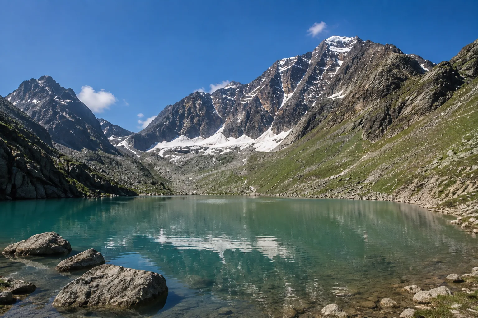
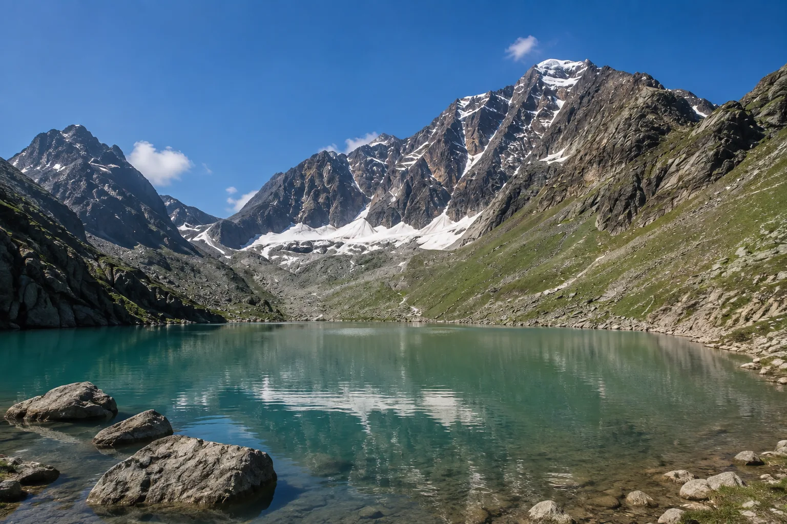
Beas Kund (3,700m): The final destination. A glacial lake sitting in a rocky, moraine-edged bowl at the foot of the Beas Kund glacier. The water is a deep grey-blue and carries the particular stillness of high-altitude lakes that feel disconnected from ordinary time. The surrounding peaks frame the lake on three sides. On a clear morning, the reflections are extraordinary.

Overview
Itinerary
Inclusion
Pickup from Manali to start point of the trek and dropoff on Day 3.
Certified trekking guides for the entire trek.
Camps with sleeping bags and mattress for Stay.
Meals : Starting from Lunch on Day 1 to Breakfast on Day 3
All trekking fees.
Exclusion
Porters for personal luggage.
Travel insurance
Any extra service
Bus train flight tickets
Things To Carry
Moisture-wicking base layer top and bottom × 2
Warm mid-layer — fleece or lightweight down jacket
Waterproof hardshell jacket (non-negotiable; rain is a daily reality in monsoon season)
Trekking trousers × 2
Waterproof trekking Shoes
Trekking socks, wool blend × 4–5 pairs
Warm hat and lightweight gloves (camp temperatures require these even in July)
40–50L trekking backpack with rain cover
Headlamp with spare batteries
Reusable water bottle × 2 (minimum 2-liter capacity total)
Sunscreen SPF 50+ — UV intensity at 3,500m is significantly higher than at sea level
UV-blocking sunglasses
Basic first aid kit — blister care, ibuprofen, altitude medication (Diamox — consult doctor beforehand)
Portable power bank (no charging on trail; Manali top-up before departure)
Small dry bags for electronics and documents
TreknGo Equipment Note: All trekking groups booked through TrekNgo at www.trekngo.com have access to equipment rental at the Manali base — sleeping bags, trekking poles, rain covers, and microspikes are all available. Rental details are confirmed at booking.
Complete Trek Information: Everything Else You Need to Know
Permits and Documentation for Beas Kund Trek
The Beas Kund trail passes through a Forest Department regulated zone and an Inner Line checkpoint at Dhundi. The following are required:
Valid Government Photo ID — Aadhaar, Passport, or Driving License
Forest Department Entry Permit — arranged by TrekNgo as part of all packages; book at www.trekngo.com
Inner Line Registration at Dhundi checkpost (mandatory for all trekkers, domestic and foreign)
Travel Insurance covering high-altitude trekking — TrekNgo strongly recommends this; some packages include it
Foreign Nationals: Passport and valid Indian visa required. No restricted area permit needed specifically for Beas Kund.
Season Guide: When to Trek Beas Kund in 2026
June — Early Season
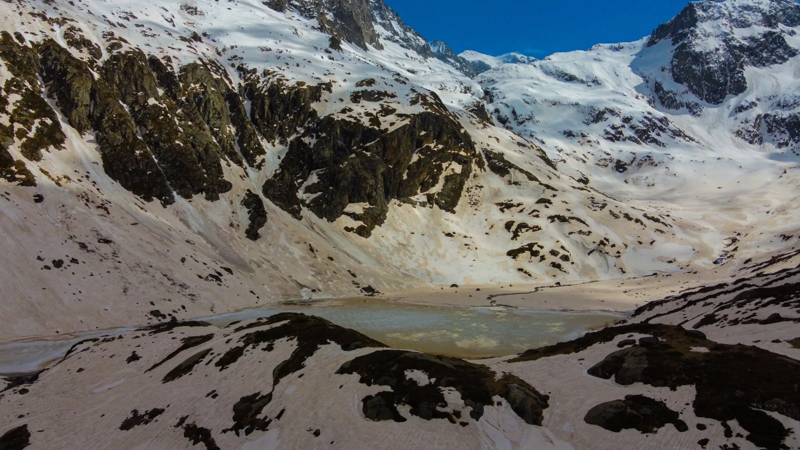
The snow from winter is still retreating from the upper sections. The lower meadows are green and alive with early wildflowers. Bakarthach and the approach to Beas Kund may carry significant snow patches. Crampons or microspikes may be needed. Crowd level: low. Experience: wild and raw.
July to August — Peak Season
The trail is fully accessible, the meadows are at maximum green, wildflowers are at peak bloom across Bakarthach, and mountain views are punctuated by monsoon cloud drama. Rain gear is essential. Leeches appear in the lower forest sections. Crowd level: moderate. Experience: lush, dramatic, full sensory overload.
September to October — Best Overall Window
This is TreknGo's most recommended window for Beas Kund. Post-monsoon clarity delivers unobstructed mountain views, the meadow grasses turn golden, temperatures are crisp but manageable, and the crowds have thinned significantly. The lake at Beas Kund in October — still, clear, reflecting the first winter snow on the surrounding peaks — is the finest version of this destination. Crowd level: low to moderate. Experience: outstanding.
November — Late Season
The trail is approaching its seasonal closure. Significant snowfall above 3,000 meters is possible. Suitable only for experienced trekkers with proper winter gear. Some years the trail remains passable through mid-November; others see early closure. Check with TrekNgo for current season status at www.trekngo.com.
Fitness and Physical Preparation
Beas Kund is classified as a Moderate difficulty trek — accessible to first-time high-altitude trekkers with appropriate preparation but demanding enough that arriving undertrained is genuinely unpleasant.
Minimum Fitness Baseline:
- Ability to walk 10–12 km with a loaded backpack (8–10 kg)
- Sustained uphill walking for 2–3 hour periods without requiring extended rest
- No acute cardiac or pulmonary conditions
- Recommended Pre-Trek Training (4–6 Weeks Before Departure):
- Daily walks of 5–8 km, progressively introducing uphill gradients
- Stair climbing (3–4 sessions per week, 20–30 minutes per session)
- Light running or cycling for cardiovascular base building
- One weekend trek or hill walk per week in the final month before the trek
Age Range: TrekNgo's Beas Kund groups have included participants from 14 to 62 years old. The key variable is fitness and preparation, not age.
Altitude Sickness: At 3,700 meters, AMS is uncommon but possible in unacclimatized trekkers. Symptoms — headache, nausea, dizziness, fatigue beyond normal trek tiredness — should be reported to your TreknGo trek leader immediately. The standard TreknGo protocol is acclimatization rest first; descent if symptoms don't resolve within 2–4 hours.
How to Reach Manali: 2026 Complete Transport Guide
By Air
Bhuntar Airport (Kullu-Manali Airport) — 50 km from Manali. IndiGo and Air India operate seasonal flights from Delhi (1 hour) and Chandigarh (40 minutes). Flight availability and frequency is weather-dependent; always book with flexible cancellation in peak season. From Bhuntar, taxis reach Manali in 1.5–2 hours.
By Road From Delhi
Volvo Bus: Multiple private and HRTC Volvo services operate nightly from Delhi's ISBT Kashmere Gate to Manali. Journey time: 13–15 hours. Comfortable, reliable, and the most popular option for backpackers.
Self-Drive: Delhi → Chandigarh → Kiratpur → Bilaspur → Sundernagar → Mandi → Kullu → Manali via NH-3. Distance: approximately 540 km; 12–14 hours.
Shared Taxi: Available from Chandigarh and Pathankot to Manali for those combining train + road travel.
By Train + Road
No direct rail connection to Manali.
Nearest major rail heads:
Chandigarh (310 km from Manali) — well-connected with Delhi, Mumbai, and other major cities; bus or taxi onward to Manali
Ambala (350 km) — similar connectivity and onward options
Jogindernagar (165 km) — served by the narrow-gauge Kangra Valley Railway; scenic but slower
Why Book Your Beas Kund Trek with TrekNgo?
This isn't a generic "why book with us" section. Here's what specifically matters about TreknGo for the Beas Kund trek.
Locally Based, Mountain Experienced:
TreknGo operates from Manali with trek leaders who have completed Beas Kund across multiple seasons — meaning they know how the trail behaves in a wet July monsoon differently from a clear October, and how to make decisions accordingly.
Small Group Sizes:
TrekNGo maintains small group sizes on all Beas Kund departures — ensuring a genuine mountain experience rather than a crowded group march. This matters at Beas Kund, where the meadow and lake have a particular intimacy that large groups disrupt.
Full-Service Trail Support:
Camp setup, kitchen crew, hot meals at altitude, and equipment support are all included in standard TrekNgo packages. You carry what you want to carry. Everything else is handled.
Responsible Trekking:
TrekNgo operates a strict Leave No Trace policy on all trails. This includes waste carry-out, designated camping zones, and active support for local guide and porter employment.
Transparent Pricing:
No hidden costs. What you see on www.trekngo.com is what you pay. Package inclusions are clearly listed and the booking process is straightforward.
Nearby Extensions: What to Combine with Beas Kund
Manali Sightseeing (Post-Trek Day):
Hadimba Devi Temple — ancient deodar cedar forest temple, 3 km from Mall Road
Old Manali — the original village settlement, quieter and more authentic than the tourist strip
Vashisht Hot Springs — natural sulphur springs; post-trek soak that your muscles will thank you for
Naggar Castle — 21 km from Manali, a beautifully preserved medieval castle with Roerich Art Gallery
Combined Trek Options via TrekNgo
Hampta Pass Trek — 5 days; moderate-high difficulty; spectacular cross-Himalayan pass connecting Kullu and Lahaul valleys; bookable at www.trekngo.com
Chandratal Lake Trek — 5–6 days; moderate; the high-altitude crescent lake of Lahaul; combining with Beas Kund into a 10-day Himachal adventure
Deo Tibba Base Camp — 6 days; moderate-strenuous; for those who want to extend their high-altitude experience toward more serious mountaineering terrain
Faq's
Yes — with important qualifications. It's not a beginner-easy walk. It's a moderate high-altitude trek that demands reasonable fitness and genuine preparation. First-timers who have put in 4–6 weeks of pre-trek training consistently report it as an incredibly rewarding and manageable experience. First-timers who arrive undertrained find it genuinely difficult. Prepare properly and it's one of the finest introductions to high-altitude Himalayan trekking available near Manali.
Beas Kund is famous as a high-altitude lake and is traditionally associated with the source region of the Beas River. The trek is also known for its alpine meadows, snow-covered peaks, streams, rocky landscapes and spectacular views of the surrounding mountains.
The commonly followed route is: Manali → Solang Valley → Dhundi → Bakarthach → Beas Kund The exact starting point, camping location and route may vary depending on road access, weather and local regulations.
Beas Kund combines a relatively short trekking experience with high-altitude meadows, a glacial lake, streams and dramatic Himalayan mountain scenery. Its proximity to Manali also makes it a popular option for travellers looking for a short Himalayan adventure. Himachal Tourism specifically lists Beas Kund among the state's notable trekking routes.
Cancellation Policy
30 - ∞ Days
25% Deduction
15 - 29 Days
50% Deduction
0 - 15 Days
100% Deduction