Dayara Bugyal Trek


BOOKING
Trekking Fee
INR 4500/-
Per Person
Select Date
Adult
Available Package options
Highlights of the trek
So What Exactly Is Dayara Bugyal? (And Why Should You Care As A Trekker)
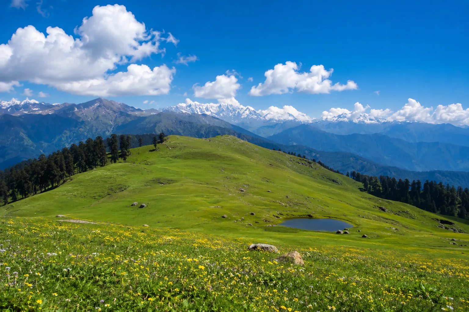
The word bugyal comes from the Garhwali language and refers to high-altitude alpine meadows found in the Uttarakhand Himalayas — open, sweeping grasslands that sit above the treeline and below the permanent snowfields. Think of them as nature's rooftops.
Dayara is one of the largest and most accessible of these meadows. Sitting at an elevation that ranges between 3,048 and 3,658 meters (roughly 10,000 to 12,000 feet), it offers something increasingly rare in Indian trekking: genuine wilderness without a six-month permit waitlist or a crowd that makes the summit feel like a metro platform.
What makes Dayara a particularly compelling All-Season trek:
The post-pandemic trekking surge has finally stabilized, meaning trail conditions have had breathing room to recover. Local homestay infrastructure in the base villages of Barsu and Raithal has meaningfully upgraded — think better bedding, warmer rooms, and hosts who've figured out exactly what traveling solo women, older trekkers, and first-timers actually need. And perhaps most importantly, the Uttarakhand Forest Department has implemented smarter carrying capacity regulations that are actively keeping the meadow from becoming another cautionary tale of overtourism.
Go now, before the algorithm fully catches up.
Where Is Dayara Bugyal? The Honest Geography
- State: Uttarakhand
- District: Uttarkashi
- Primary Base Village: Barsu
- Secondary Base Village: Raithal
- Elevation of Meadow: 3,048m – 3,658m (10,000 – 12,000 ft)
- Nearest Town: Uttarkashi (~42 km from Barsu)
- From Dehradun: ~175 km (approximately 6–7 hours by road)
- From Delhi: ~450 km (approximately 10–12 hours by road or overnight bus)
- GPS Coordinates: 30.8952° N, 78.4023° E
The meadow itself sprawls dramatically across the ridge, framed on all sides by a who's-who of Himalayan peaks — Bandarpunch (6,316m), Black Peak (6,387m), Draupadi Ka Danda II, and the distant white giants of the Gangotri range. On a clear autumn morning, the views from Bakaria Top — the highest point of the Dayara ridge — are the kind that make seasoned trekkers go quiet.
The Seasonal Reality Check: When Should You Actually Go?
Forget the generic "best time to visit" templates. Here's what each season genuinely looks and feels like on the ground in 2026 — including the bits most guides conveniently leave out.
April to June — The Wildflower Window
Who It's Perfect For: First-timers, photographers, families with older kids, anyone escaping the pre-summer heat
The snowmelt that begins in late March triggers one of nature's more quietly dramatic shows. By April, the lower meadow edges are already dotted with primulas and anemones. By late May, the entire bugyal is carpeted in wildflowers — Brahmakamal, Himalayan Blue Poppy, yellow cinquefoil — in a display that genuinely doesn't need a filter.
Trail conditions during this window are among the year's best. The path from Barsu is firm underfoot, the forest section through oak and rhododendron is perfumed and cool, and the final push to the meadow rewards you with views that justify every uphill step.
Temperatures: 5°C to 18°C (nights can dip to 2°C at camp)
Crowd Level: Moderate and manageable
What to Watch For: Some high sections may still carry residual snow patches through April — beautiful, but worth packing gaiters for
July to Mid-September — The Controversial Season (That's Actually Worth It)
Who It's Perfect For: Experienced trekkers, monsoon chasers, landscape photographers who know what they're doing
Let's be straightforward: most guides will tell you to skip the monsoon. Most guides are playing it safe.
Yes, the trails get slippery. Yes, you'll encounter leeches in the lower forest sections. Yes, afternoon clouds roll in with theatrical predictability. But here's what those guides don't mention — Dayara Bugyal during the monsoon is an almost aggressively green landscape that looks genuinely otherworldly. The meadow grass reaches knee height. Waterfalls appear on hillsides that are bone dry in October. The absence of crowds gives the entire place a quality of solitude that peak season simply cannot replicate.
If you're comfortable on wet terrain, carry the right gear, and are flexible about summit views, the monsoon window is Dayara's best-kept secret.
Temperatures: 8°C to 15°C
Crowd Level: Low — genuinely peaceful
What to Watch For: Start treks early (before noon) to avoid afternoon showers; carry waterproof covers for all bags and electronics
Mid-September to November — The Season Everyone Should Experience Once
Who It's Perfect For: Everyone. Seriously, everyone.
If you can only go once, go in autumn.
The monsoon departure leaves behind an atmosphere so clear it almost feels artificially enhanced. The Himalayan panorama from Bakaria Top in October is the kind of view that ends up as someone's phone wallpaper for years. The meadow transitions from deep green to gold and amber. The nights are cold but manageable. The days are warm enough for a t-shirt by 11AM.
October remains the single most sought-after month for Dayara Bugyal bookings — and for very good reason. If you're planning for October, book your homestay and guide at minimum 6–8 weeks in advance. The better operators fill up fast.
Temperatures: 0°C to 15°C (nights require a solid sleeping bag)
Crowd Level: High in October, tapering in November
What to Watch For: Early November can bring the first winter snowfall — which is either magical or logistically complicated depending on your preparation level
December to March — The Snow Trek
Who It's Perfect For: Snow trekking enthusiasts, beginners wanting their first winter Himalayan experience, anyone who's never seen a landscape this white
This is where Dayara Bugyal genuinely separates itself from the competition.
When winter arrives in earnest — typically by late November — the entire 28 square kilometers of meadow disappears under snow. What remains is a vast, silent, heartbreakingly beautiful white expanse bordered by some of the most dramatic peaks in the Garhwal Himalaya. The bugyal has historically been used as a natural skiing ground by locals, and in recent years, guided snow trekking and beginner ski experiences have become increasingly organized and accessible.
Snow depth across the meadow ranges between 3 and 15 feet depending on the year and specific location. The Barsu route remains the most reliable access point through winter, though the forest section requires microspikes or crampons from December onward.

Overview
Itinerary
Inclusion
Stay in a guest house in Uttarkashi on Day 1.
All Meals (Lunch, eve snacks, Lunch and Dinner : From Dinner on Day 1 to Breakfast on Day 4.
Guide for the entire trek.
Local transportation from Uttarkashi to initial point of the trek
Trekking fees, Forest fees.
Exclusion
Porter for personal luggage
Any extra meal or transportation
Any travel insurance, medical insurance
Things To Carry
40–60L trekking backpack with rain cover.
Good-quality waterproof trekking shoes with ankle support with 2-3 pairs od socks.
Clothing - Base Layer - 2–3 quick-dry T-shirts, with 2-3 pants (make sure the clothes are light weighted), Fleece or sweatshirt as 2nd layer, Top layer - Windproof padded insulated jacket.
Caps, Woolen caps, gloves, Neck warmer.
Accessories : Sunshades, Sunscreen, Powerbank, Torch, lip balm, moisturiser, Personal medicines and basic first-aid kit.
Small garbage bag for carrying back waste
Personal medication and essential prescriptions
2 reusable water bottles or hydration bladder
Faq's
Yes — and increasingly so. The base villages of Barsu and Raithal have a well-established community of local women guides and homestay operators. Solo female trekkers consistently rate this trail among Uttarakhand's most welcoming. Going with a registered local guide is recommended for any solo trekker regardless of gender.
For October, book your guide, homestay, and transport at least 6–8 weeks in advance. Good operators fill up. The better homestays fill up faster.
At 3,400–3,650 meters, altitude sickness is possible but relatively uncommon in healthy trekkers who ascend gradually. Spending a night in Uttarkashi (1,158m) or Barsu (2,850m) before the trek provides meaningful acclimatization. Consult your doctor about Diamox if you have a history of altitude sensitivity.
BSNL provides the most reliable (though still patchy) coverage on the trail. Jio and Airtel have signal at base villages but fade significantly above the forest line. Plan for approximately 12–18 hours of limited to no connectivity on trail — which, honestly, is half the point.
Cancellation Policy
30 - ∞ Days
25% Deduction
15 - 29 Days
50% Deduction
0 - 15 Days
100% Deduction